Hurricane Florence Update
Press Release #8: Hurricane Florence: Curfew for Hyde County Starts Thursday at 9:00 pm
The Hyde County Board of Commissioners have issued a curfew for all of Hyde County, effective at 9:00 pm, Thursday, September 13. The curfew will be in effect daily, from 9:00 pm to 5:00 am until further notice.


Press Release #7: Hurricane Florence: Hurricane and Storm Surge Warnings Issued for Hyde County
Hyde County is currently under a Hurricane Warning. A Hurricane Warning means that hurricane conditions are expected somewhere within the warning area. A warning is typically issued 36 hours before the anticipated first occurrence of tropical storm force winds, conditions that make outside preparations difficult or dangerous. Preparations to protect life and property should be rushed to completion.
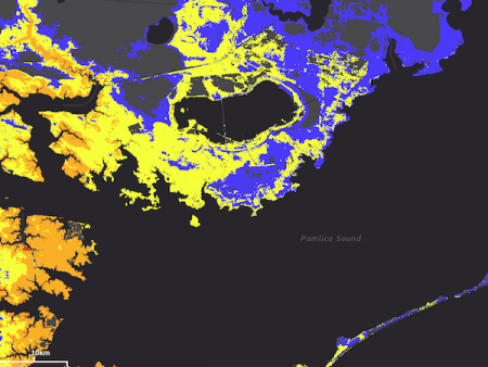
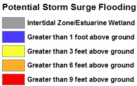
Hyde County is also under a Storm Surge Warning. A Storm Surge Warning means there is a danger of life-threatening inundation, from rising water moving inland from the coastline, during the next 36 hours in the indicated locations. For a depiction of areas at risk, please see the National Weather Service Storm Surge Watch/Warning Graphic, available at http:// hurricanes.gov. This is a life-threatening situation. Persons located within these areas should take all necessary actions to protect life and property from rising water and the potential for other dangerous conditions. Promptly follow evacuation and other instructions from local officials.
While the 2:00 pm National Hurricane Center (NHC) update has Hurricane Florence's track moving slightly to the south of yesterday's prediction, it is also predicting the storm to linger off the coast before moving to the south. This shift will bring increased rain to an already extremely high prediction. According to the NHC, coastal North Carolina could see between 20-30 inches of rain over the course of the storm, with localized areas of up to 40 inches. Combined with storm surge predictions of up to 6 feet in our area, higher in some localized areas, the potential for a serious flooding event is extremely high.
Hurricane Florence is still forecast to be an extremely dangerous major hurricane when it nears the U.S. coast late Thursday and Friday. Hurricane force winds extend outward up to 70 miles from the center and tropical-storm-force winds extend outward up to 175 miles.The last ferry from Ocracoke Island left at 9:30 am today. According to the NCDOT Ferry Division, 2,181 people and 1,074 vehicles were evacuated from Ocracoke on the Hatteras, Cedar Island and Swan Quarter routes between 1:00 pm Monday and today. Evacuations of mainland Hyde County are still ongoing.
We have received reports that the Knightdale High School Shelter is full. If you have not evacuated yet and need a shelter to go to, Hyde County residents can use Southeast Raleigh High School. It is located at 2600 Rock Quarry Rd, Raleigh, NC 27610.
If you have any questions or immediate concerns, contact the Emergency Operations Center at 252-926-3715.
The Hyde County Board of Commissioners have issued a curfew for all of Hyde County, effective at 9:00 pm, Thursday, September 13. The curfew will be in effect daily, from 9:00 pm to 5:00 am until further notice.
North Carolina Emergency Management officials have reported that all Wake County shelters are full. They are now directing anyone that still needs to evacuate to LJVM Coliseum, 2825 University Parkway, Winston-Salem, NC 27105. For any assistance finding shelters, call 211.


