Walking, Shelling, Surviving
But it's still a neat place to explore under the cover of many, many layers. Like, a lot of layers. Multiple pairs of socks, several layers of shirts, a windbreaker/waterproof jacket, ear covers/a hat, and possibly gloves. On super windy days, I wear all that plus I put a thin layer of Vaseline on my face because windburn is miserable, and Vaseline does a great job of preventing dry, windburned skin. It took me a bit to figure out that lotion, even the heavy-duty stuff, wasn't enough, so, in true only-child fashion, I wrote (emailed) home and asked my parents for some advice. They're both super outdoorsy and know a thing or two, so I figured they'd be able to offer some advice. They did; however, I already had a similar lotion to the one recommended, so I decided it was time to go a step further. And that's how I thought of trying Vaseline. Problem solved.
In any event, it can get really, really windy on the beach, so being over-dressed and moisturized is probably better than not having enough coverage and getting red, irritated skin. Also, I wear waterproof hiking boots or waterproof hiking shoes (over my two pairs of socks, of course) because anything that says "waterproof" is also "windproof". Covering your ears is also quite important. My favorite new ear covers were given to me as a Christmas gift and are called "ear bags". Each ear gets it's own "bag" that snaps into place. They're like snap bracelets, except they're made of fleece and snap onto your ears.
Okay, so now you're outfitted and ready to go!...almost. I suggest having a backpack (or something similar) filled with essential supplies if you're planning on being out there for a while, especially if you do not have a vehicle in close proximity. I usually walk on the beach for anywhere between four to six hours at a time, so I bring a lot of supplies. I take water for myself and my two dogs, peanuts, treats (for the dogs), and extra layer of clothing (just in case it's truly arctic outside), gloves, plus my cell phone (kept on silent and primarily used for checking the time and mileage), and all my camera gear. Oh, and I also bring poop bags (for the dogs, not myself). I also pack tissues because the cold has a funny way of bringing out the runny nose in people.
Okay, now you're outfitted and ready to go! Woo hoo!
I have two favorite starting points for walks. I've mentioned in previous articles that I do not have a 4WD vehicle, so when I drive to a starting point, I usually park near ORV Ramp 72 or the National Park Service campground, where ORV Ramp 68 is located. Lately, I've been walking from my house or my husband will drop me off at the NPS campground and I go from there. No matter how I get there, the walk over the dunes and onto the beach is spectacular. If you look south, there's no one. If you look north, you'll get blasted in the face with wind and sometimes even sand, but still, there's no one in sight, so yay!
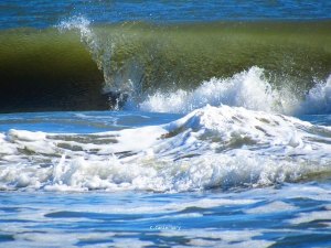
Walking south from the NPS campground/ORV Ramp 68 is awesome because the two miles between this spot and just passed the Day Use Area (also called "Lifeguard Beach") is designated for pedestrian use only (this area can also be accessed from the airport/ORV Ramp 70 by heading north).
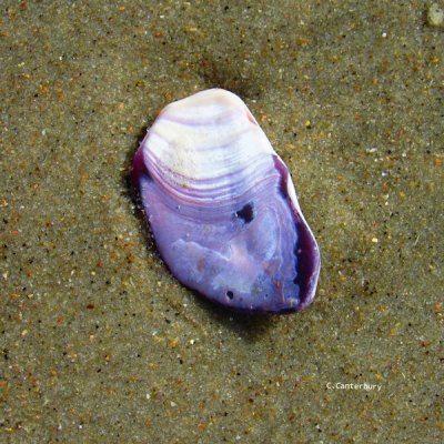
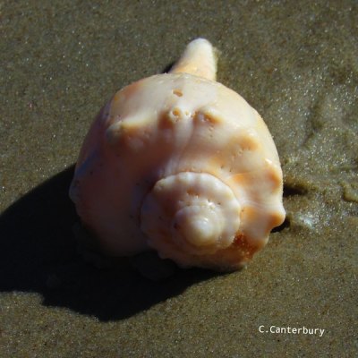
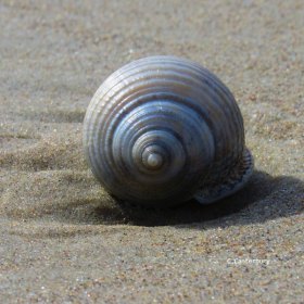
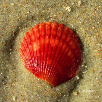
Here I have found numerous whelks and Scotch bonnets, plus a wide array of broken, wave-battered colorful shells. On my most recent excursion, I saw dozens of skate egg cases washing up and lots of broken sand dollars, both of which I hadn't previously seen in such large quantities.
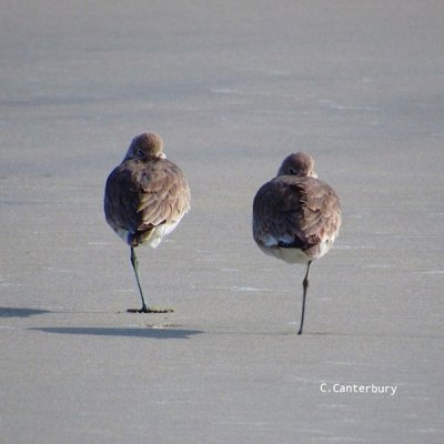
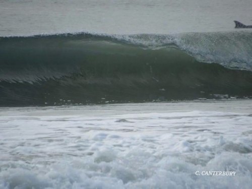
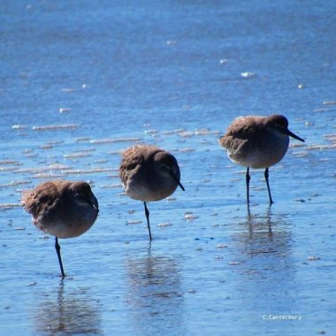
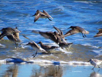
And then there were the birds. Willets and Pipers can be observed primarily in large groups scurring back and forth, following the waves in and out while sticking their beaks into the sand searching for food. Double-crested Cormorants, Brown Pelicans, and Northern Gannets can be spotted along the shoreline, diving for fish, floating in the water, or gracefully flying over the rolling waves. And of course gulls are still hanging around, but they seem to be more loner birds than the others. They just stand there...on one foot...looking cold and angry. Of course they could be trying to determine if Porter, my puppy, would make a good meal. Compared to Harley he's still pretty small, so you never know. Also, keep your eyes open for dolphins! I've seen a bunch lately while walking south from the campground. You'll see their dorsal fin poking through the water as they swim just off-shore, behind the breaking waves.
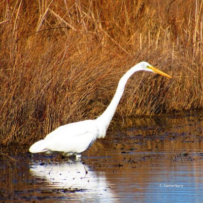
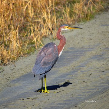
If you want a change in scenery, check out ORV Ramp 72. With canals and salt marsh on both sides of the ramp, you have a good chance of seeing Great Egrets, Tri-colored Herons, Green Herons, Ibises, and other marshland creatures. This week I saw an otter scurry across the sandy ramp and make its way into the protection of the salt marsh and tall grasses. Not only did seeing the otter make me do a double-take, my dogs even stopped and stared in wonderment.
From the beach-end of ORV Ramp 72, it's a serene two-mile walk to Ocracoke's southern most point, where you'll get to observe quite a lot in a relatively short distance. The sand dunes can offer a great barrier between you and the wind (depending on the wind direction), and you'll realize what a huge difference they make once you get beyond them. When the line of dunes ends, the island becomes perfectly flat, allowing the elements to really get you, but the scenery is fantastic.
To your right you'll see sand and mudflats, where nesting shore birds settle during the warmer months. You may also get a glimpse of ferries approaching Ocracoke Harbor from the Mainland and be able to make out the blurry outlines of buildings in the village. To your left you'll see the Atlantic Ocean and shore birds, and when you look straight ahead, you'll see a whole lot of open space, with Ocracoke Inlet in the distance. It's spectacular.
Battling the wind is worth seeing how the island opens up and flattens out, and, as you continue south, getting to observe how the water moves from the ocean through the inlet and into the sound is really neat too. Once you turn to head back north, you'll probably really feel the wind, hitting you almost straight on from the north-east. This is when the layers of head coverings I described earlier come in handy.

Remember the character Kenny from the television show South Park? I look just like him when I'm bundled up. I draw the hood of my fleece and windbreaker around my chin and head so tightly that only a small portion of my face and my sunglasses can be seen. My dogs usually aren't very happy with me when the wind is fierce and we're tackling it head-on (so really whenever we go north this time of year) and they let me know their displeasure through facial expressions and whining. Anytime we do happen to see a vehicle, they both perk up a bit, as if someone has arrived to rescue them from their horribly rough lives.
In late December, I went up to the north end of the island during a pretty severe weather event. I had never been on the beach under these extreme conditions, and my curiosity – coupled with the desire to tire out my dogs – got the best of me. Not only was the wind blowing viciously, it was also raining. The rain and wind stung my face as I headed toward the site of the Life Saving Station that once stood near Hatteras Inlet. The wind was blowing so hard, in fact, sand was even being blasted into my face. I may have felt a little sorry for my dogs on this walk, as their sweet faces were covered with tiny grains – but only a little sorry. What seemed like miles and miles of walking couldn't have been more than a couple, but making our way against the wind was no easy task. With our heads down as much as possible we trudged on and finally reached the remnants of the Life Saving Station. The Station was built in 1949 and by 1994, the buildings – except for some pilings – had been washed away. Seeing photos of the deterioration of the Station is one thing; being out there in extreme weather makes it easy to understand how vulnerable the island is to the power of wind and water. By the time we got back to the car, the dogs and I were exhausted. I wore head-to-toe waterproofs, but my efforts to keep the gear in place proved useless due to the unrelenting wind. We returned home tired, cold, and damp.
The northern tip of Ocracoke is a neat place to explore…. in more favorable weather conditions. If you park in the paved lot directly across from the ferry docks, you can access the Pamlico Sound, Hatteras Inlet, and finally the ocean side of the island. Just make sure you know the tide schedule if you want to return the way you came. Once the tide comes up, the mudflats fill with water and you will be cut off from the sound-side beach near the parking area. If that happens, though, just walk alongside the ocean and head south. ORV Ramp 59 is located close enough and will allow you to get back to the parking lot. You will have to walk a short distance on Highway 12, however. You can also access the Ocracoke's north end by parking in the lot next to ORV Ramp 59, which will lead you directly to the ocean.
The north end, just like the south, is full of wildlife and seashells. There are more brush-type plants on the north end, so herons and egrets may be seen more frequently, along with the typically seen shore birds. And, also like the southern end, when you get passed the dunes into the open, that wind might get you, so be prepared to cover up this time of year.
No matter where you go on the beach or how you get there, it's Ocracoke, and Ocracoke is awesome, so you're sure to have a wonderful beach adventure!
