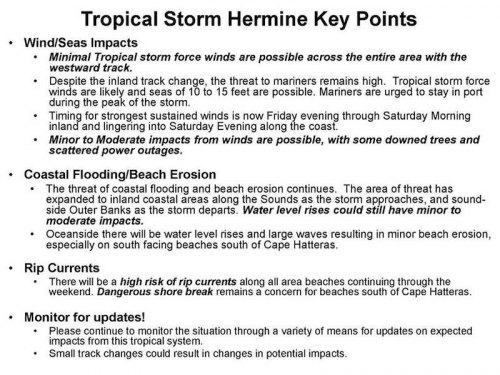
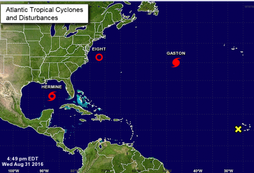
Tropical Depression Nine strengthened to a tropical storm (named Hermine) this afternoon and initial forecast indicated that the system would pass just off the coast of North Carolina, but this afternoon there has been a dramatic westward shift in the model guidance and forecast track. Currently, Hermine is forecast to track between Raleigh and Rocky Mount. The westward shift has significantly changed the impacts forecast for eastern North Carolina. The summary of updates are as follows:
TD #9 strengthened into Tropical Storm Hermine earlier today. The track has also shifted drastically to the west and slowed slightly. The new track keeps the center of the storm inland as it lifts north of Florida.
The threat of strong tropical storm force winds along the coast has diminished, but the forecast wind field has expanded with a large area of minimal tropical storm force winds from well inland through the coastal waters.
The threat of minor coastal flooding has expanded into the western portion of the Pamlico Sound.
Please refer to the attached Eastern North Carolina Threat Assessment, released by the NWS Office Newport/Morehead City at 6:00 PM, for further information.
Local Emergency Protective Measures

Confidence in the Tropical Storm Hermine forecast should increase overnight into the early morning. North Carolina Emergency Management has initiated a conference call schedule starting in the morning and local decision makers may be engaged in deliberations regarding the implementation of emergency protective measures tomorrow. The Hyde County Emergency Services Department will issue advisories as appropriate and we are urging everyone to closely monitor this system.
