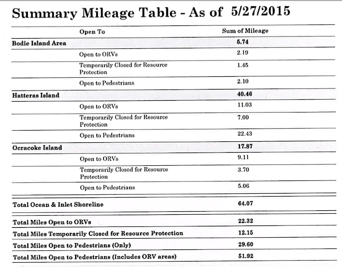
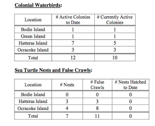
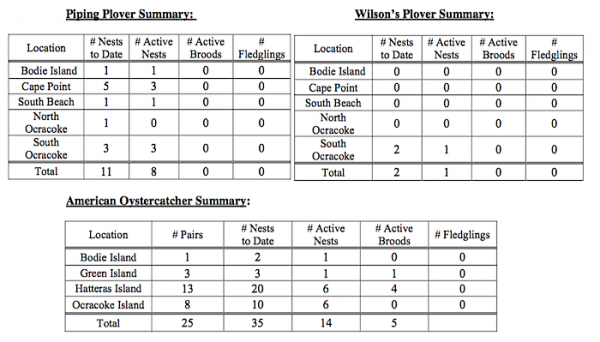
For more information on the Google Earth interactive site and the park's Off-Road Vehicle webpage, see: http://www.nps.gov/caha/planyourvisit/beachactivities.htm#ORV
On-site signage, of the beaches in the Seashore, is the most accurate and current indications of areas that are open to public access or closed to entry. Closed areas are clearly marked with symbolic fencing and signs that are subject to change during the wildlife breeding season.
Additional webpage links that may be of interest are:
http://www.nps.gov/caha/learn/management/2015ndaact.htm
http://www.nps.gov/caha/learn/index.htm
Thank you for your interest in Cape Hatteras National Seashore!


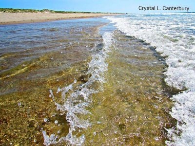
To see more of Crystal's beautiful beach photography, like the Current's Facebook page!
